01◎
Early bushfire
detection
AI-assisted detection identifies potential smoke and fire signatures to support earlier assessment and response.
DETECT & ASSESSUnderstand what’s happening.
Even where you can’t be.
Remote observation, AI-assisted detection and environmental insight. Connected in one adaptable, off-grid solution.
Explore the platform ↓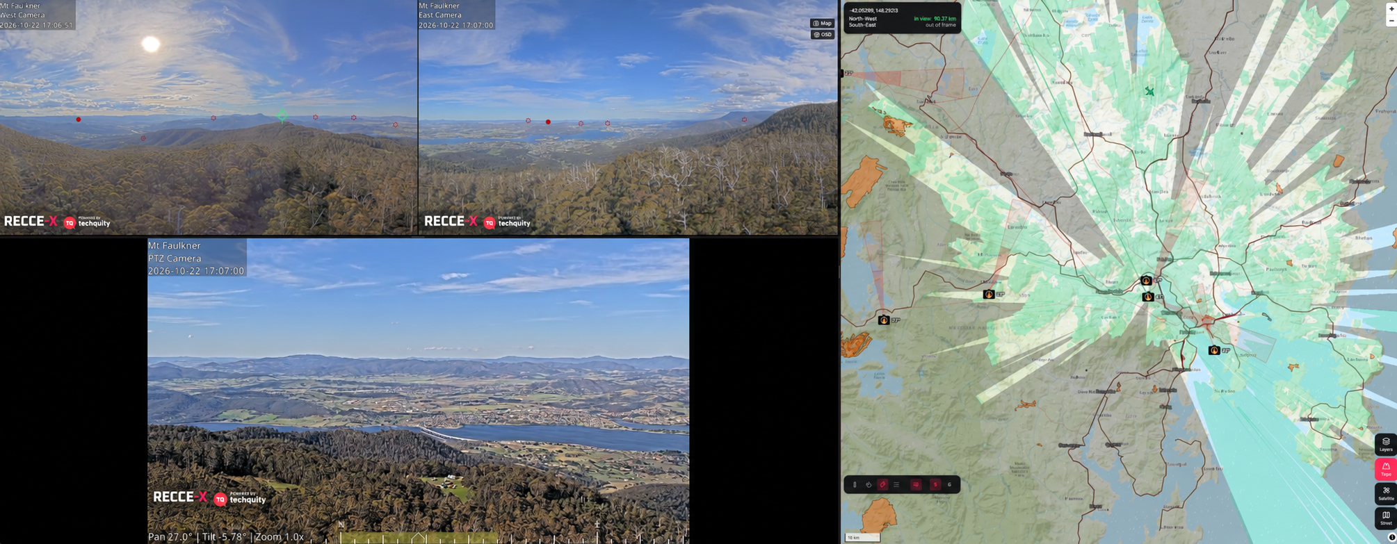
Bring visual evidence and environmental context together, helping teams assess conditions and coordinate their next step.
AI-assisted detection identifies potential smoke and fire signatures to support earlier assessment and response.
DETECT & ASSESSSee the wider landscape, then examine the detail with high-definition panoramic and remotely controlled PTZ cameras.
OBSERVE & INSPECTIntegrate weather, air quality and environmental sensors to put changing conditions into context.
MEASURE & UNDERSTANDConnect remote sites to central monitoring, recording and analytics through a link suited to each location.
CONNECT & MONITORFrom existing fire towers to remote ridgelines, RECCE-X brings cameras, power and communications together in an integrated installation.
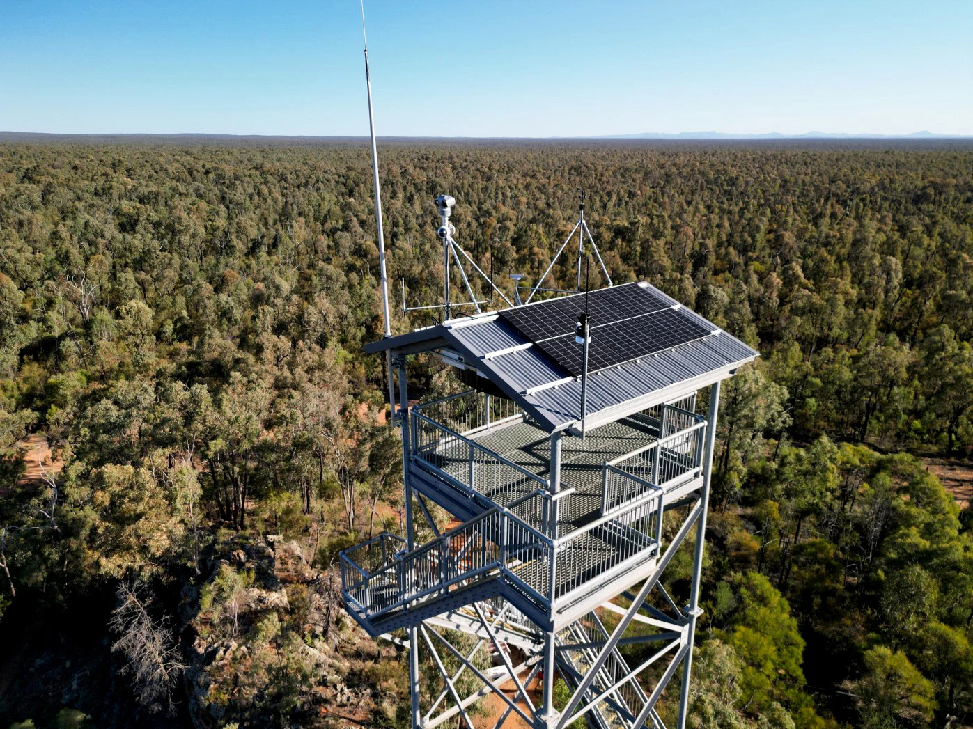
Equip a suitable tower with panoramic and PTZ cameras, solar generation, battery storage and a remotely managed network. Camera and solar mounts are configured for the structure and site.
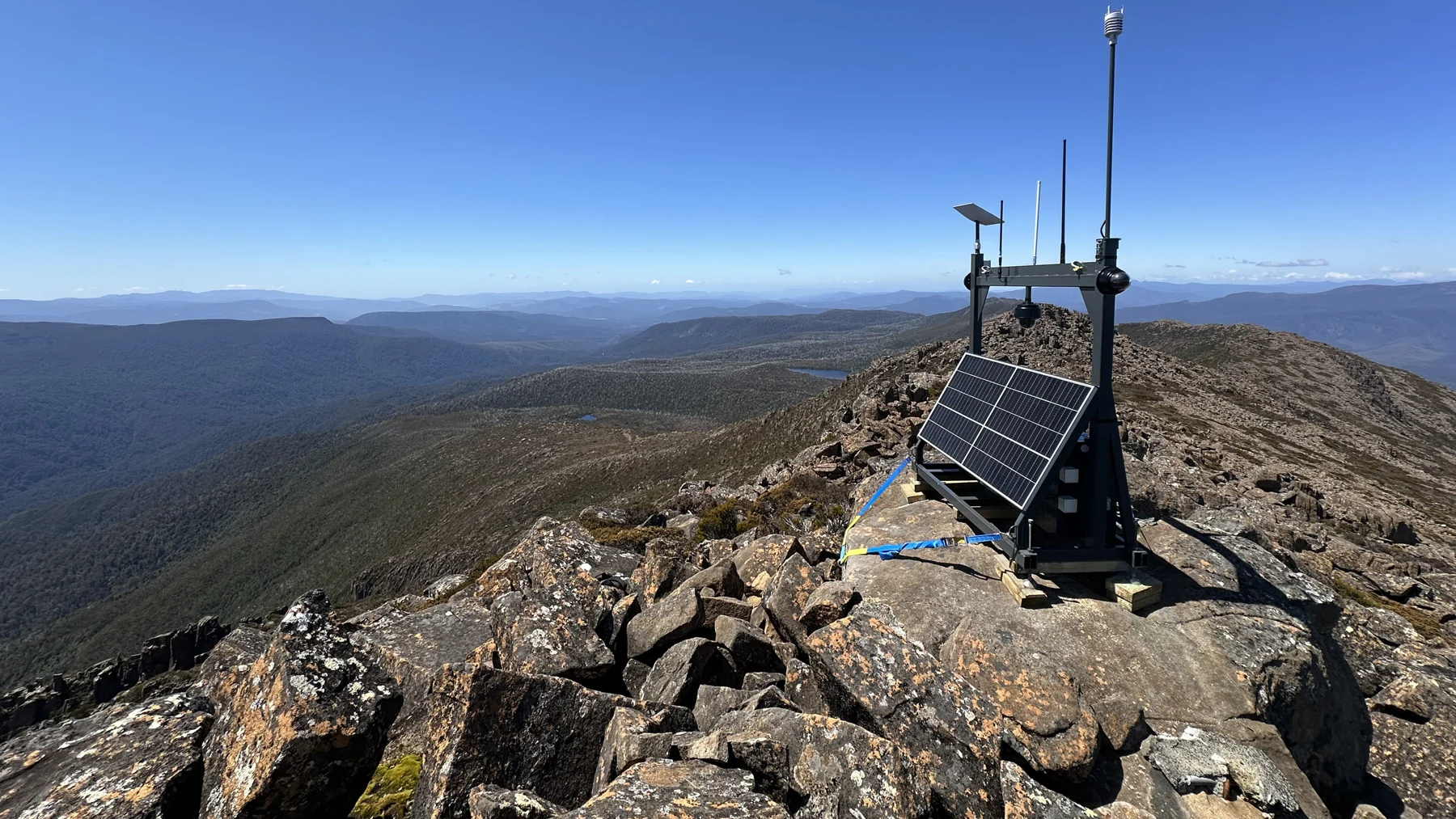
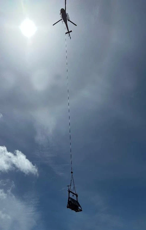
A rugged, solar-powered unit brings monitoring to locations where permanent infrastructure is impractical. Vehicle or helicopter deployment supports access to challenging terrain.
Camera coverage, energy storage and communications are selected together. Solar yield, terrain, equipment load and environmental conditions determine the final configuration.
Explore actual interface captures. Move from site coverage to camera detail, detection review and system health.
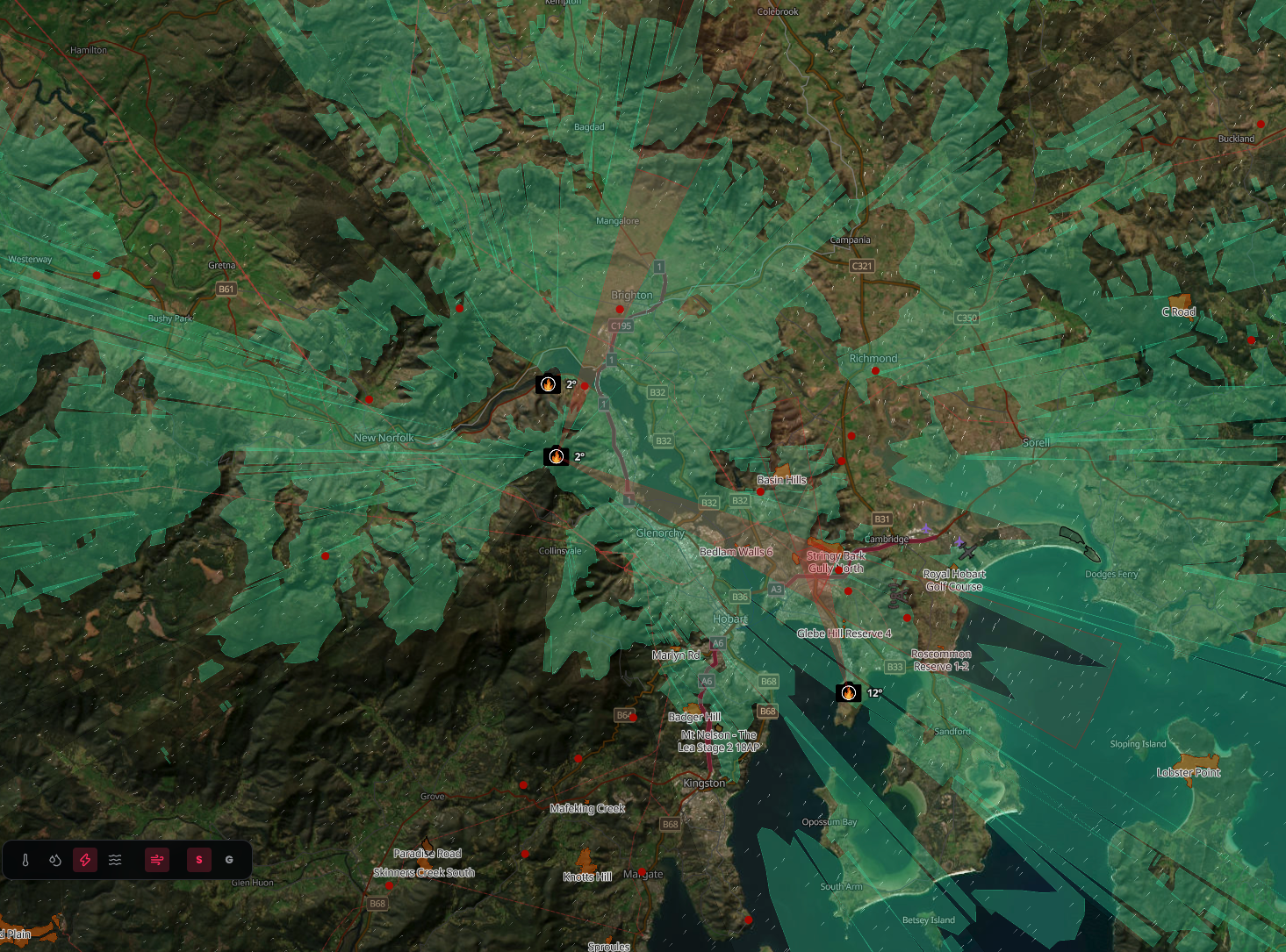
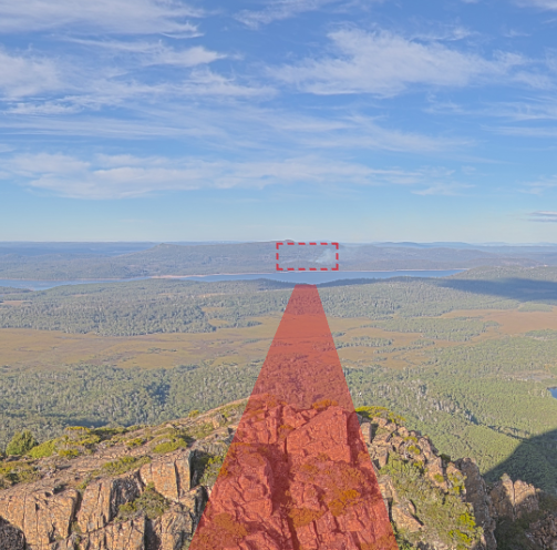
Visualise each site’s viewshed. Mouse-linked raycast crosshairs display bearing and distance to help relate the camera view to the landscape.
Actual dashboard captures supplied for illustration. Readings and detections shown are captured examples, not a live feed.
A stand-alone platform for locations where mains power is unavailable or unreliable.
Start with a standard package, then adapt camera coverage, solar generation, battery storage and connectivity to the needs of each site.
Download the capability flyer ↗Solar and battery capacity configured around the location, equipment and operating requirements.
LTE (4G / 5G), Starlink satellite or private microwave links back to central monitoring and analytics.
Optional weather and environmental sensors, LoRa networks and emergency aircraft tracking.
Define the area to observe and the operational information your team needs.
Review camera placement, power requirements and available communications.
Confirm the equipment configuration and develop a site-specific scope of works.
The standard package supports indicative pricing and site selection. Each location requires further assessment to establish its exact configuration and scope.
Combine wide-area imagery with local conditions to support fire management teams, incident controllers and land managers.
Observe burn areas and local weather to support operational awareness during planned burns.
Use AI-assisted smoke detection and detailed camera views to assess potential ignitions.
Interrogate the landscape after lightning activity and inspect areas of concern remotely.
Follow visible fire progression and share situational context to inform response and resource coordination.
Extend the platform with sensing, aircraft awareness and integration options selected for the location and operational needs.
Measure wind speed and direction, temperature, humidity, rainfall and barometric pressure. Optional sensors add fuel moisture, soil moisture, UV and solar radiation.
A LoRaWAN gateway connects compatible field sensors across the surrounding landscape. Coverage is assessed against terrain, antenna placement and site conditions.
Optional ADS-B reception adds position information from transmitting aircraft to support awareness around fire operations, subject to reception coverage.
Bring imagery and sensor data into central monitoring, recording and analytics. Integration with external systems can be scoped to the required data interfaces.
Ongoing maintenance and management services can include portal access, camera controls, sensor data and remote system health monitoring.
Plan your installation ↗Explore a RECCE-X solution for your landscape,
infrastructure or environmental monitoring needs.